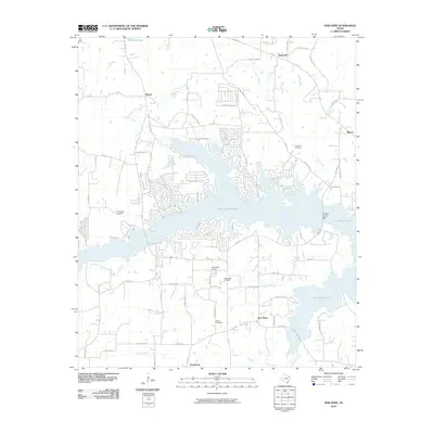
2010 Map of New Hope
USGS Topo · Published 2010About this map
Lake Cypress Springs and Lake Bob Sandlin dominate the landscape of Franklin County, Texas, joined by the Franklin County Dam in this 2010 survey. These reservoirs transformed the local topography, which was once defined by the winding paths of Panther Creek and Stouts Creek. The presence of the New Hope Oil Field reflects the region's industrial ties to energy extraction, while the surrounding rural settlements like Hopewell and Majors maintain their traditional footprints along a network of farm roads. Genealogists will find significant detail in the mapping of local burial sites, including Rock Hill Cemetery and Snodgrass Cemetery. The map also captures modern recreational developments like Tidewater Camp, showing the evolution of the area from a strictly agricultural and petroleum-based economy to one centered on its massive water resources.
Find a feature on this map
67 named features on this map. Tap any name to fly to it.
Don’t see what you’re looking for? This feature index may not catch every label — zoom into the map to look around manually.
Map Details
Editions of this 2010 New Hope Map
This is the sole edition of this map. No revisions or reprints were ever made.
Other maps of this area

1953 · Texarkana
USGS Topo · 1:250,000

1956 · Texarkana
USGS Topo · 1:250,000

1956 · Tyler
USGS Topo · 1:250,000

1960 · Winnsboro
USGS Topo · 1:24,000

1960 · Newsome
USGS Topo · 1:24,000

1960 · Leesburg
USGS Topo · 1:24,000

1964 · Mount Vernon
USGS Topo · 1:24,000

1964 · Saltillo
USGS Topo · 1:24,000

1964 · Purley
USGS Topo · 1:24,000

1965 · Winfield
USGS Topo · 1:24,000