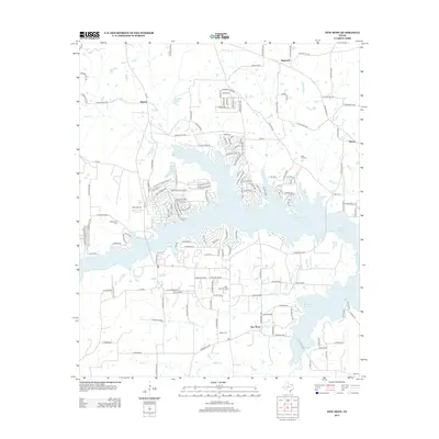
2013 Map of New Hope
USGS Topo · Published 2013About this map
The New Hope Oil Field dominates the central landscape of this Franklin County quadrangle, situated just north of the community of New Hope. The area is defined by the convergence of large-scale water management and industrial extraction, with the western reaches of Monticello Reservoir and the expansive Lake Cypress Springs shaping the residential and recreational layout of the terrain. Local history is anchored by several burial sites, including Snodgrass Cem near the western edge and Rock Hill Cem to the east, which suggest the deeper roots of rural settlements like Majors and Hopewell. The road network, including Farm Road 3122 and FM-115, connects these older hamlets with newer developments and seasonal locations like Tidewater Camp. Waterways such as Stouts Cr and Andys Cr provide the natural drainage for a region that transitioned from traditional farming into a hub for energy production and reservoir-based living.
Find a feature on this map
155 named features on this map. Tap any name to fly to it.
Don’t see what you’re looking for? This feature index may not catch every label — zoom into the map to look around manually.
Map Details
Editions of this 2013 New Hope Map
This is the sole edition of this map. No revisions or reprints were ever made.
Other maps of this area

1953 · Texarkana
USGS Topo · 1:250,000

1956 · Texarkana
USGS Topo · 1:250,000

1956 · Tyler
USGS Topo · 1:250,000

1960 · Winnsboro
USGS Topo · 1:24,000

1960 · Newsome
USGS Topo · 1:24,000

1960 · Leesburg
USGS Topo · 1:24,000

1964 · Mount Vernon
USGS Topo · 1:24,000

1964 · Saltillo
USGS Topo · 1:24,000

1964 · Purley
USGS Topo · 1:24,000

1965 · Winfield
USGS Topo · 1:24,000