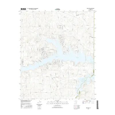
2016 Map of New Hope
USGS Topo · Published 2016About this map
Lake Cypress Springs dominates the central landscape of this Northeast Texas quadrangle, where the waters of Brushy Creek and Panther Creek are impounded. To the southeast, the map shows the upper reaches of Lake Bob Sandlin and the Monticello Reservoir, illustrating a region heavily defined by mid-century water management projects. Scattered around these reservoirs are the older foundations of the community, including small settlements like Hopewell, Majors, and Macon. Genealogists will find several family and community landmarks preserved in the record, such as Snodgrass Cem, Rock Hill Cem, and Bethel Cem. The road network, including Farm Rd 21 and FM 3122, connects these rural points across a terrain carved by numerous tributaries like Andys Creek and Stouts Creek.
Find a feature on this map
151 named features on this map. Tap any name to fly to it.
Don’t see what you’re looking for? This feature index may not catch every label — zoom into the map to look around manually.
Map Details
Editions of this 2016 New Hope Map
This is the sole edition of this map. No revisions or reprints were ever made.
Other maps of this area

1953 · Texarkana
USGS Topo · 1:250,000

1956 · Texarkana
USGS Topo · 1:250,000

1956 · Tyler
USGS Topo · 1:250,000

1960 · Winnsboro
USGS Topo · 1:24,000

1960 · Newsome
USGS Topo · 1:24,000

1960 · Leesburg
USGS Topo · 1:24,000

1964 · Mount Vernon
USGS Topo · 1:24,000

1964 · Saltillo
USGS Topo · 1:24,000

1964 · Purley
USGS Topo · 1:24,000

1965 · Winfield
USGS Topo · 1:24,000