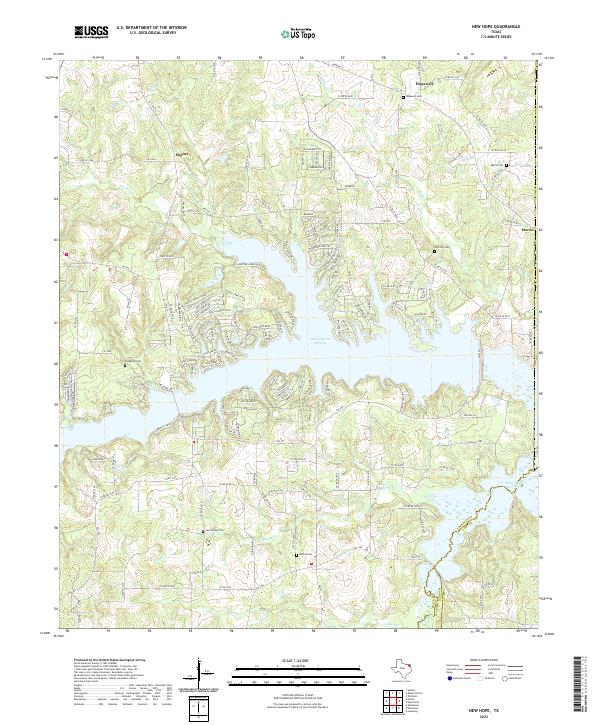
2022 Map of New Hope
USGS Topo · Published 2022About this map
Lake Cypress Springs dominates the central landscape of this East Texas region, its sprawling fingers reaching into the surrounding woodland and rural homesteads. The water-oriented layout of the shoreline contrasts with the traditional agricultural settlements of Hopewell, Macon, and Majors, which are anchored by a series of long-standing community landmarks. Genealogists will find significant value in the distribution of burial grounds across the terrain, including Hopewell Cem, Macon Cem, and Rock Hill Cem. To the southeast, the Monticello Reservoir edges into the frame, marking the boundary where Franklin and Camp counties meet. The intricate network of local drainage, such as Stouts Cr and Indian Cr, illustrates the natural watershed that precedes the modern reservoirs. A web of farm-to-market roads, including FM 115 and FM 3007, connects these small communities and provides the primary infrastructure for this rural transition zone.
Find a feature on this map
69 named features on this map. Tap any name to fly to it.
Don’t see what you’re looking for? This feature index may not catch every label — zoom into the map to look around manually.
Map Details
Editions of this 2022 New Hope Map
This is the sole edition of this map. No revisions or reprints were ever made.
Other maps of this area

1953 · Texarkana
USGS Topo · 1:250,000

1956 · Texarkana
USGS Topo · 1:250,000

1956 · Tyler
USGS Topo · 1:250,000

1960 · Winnsboro
USGS Topo · 1:24,000

1960 · Newsome
USGS Topo · 1:24,000

1960 · Leesburg
USGS Topo · 1:24,000

1964 · Mount Vernon
USGS Topo · 1:24,000

1964 · Saltillo
USGS Topo · 1:24,000

1964 · Purley
USGS Topo · 1:24,000

1965 · Winfield
USGS Topo · 1:24,000