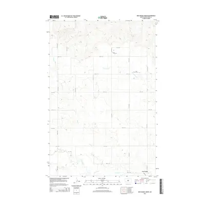
2014 Map of New Hradec North
USGS Topo · Published 2014About this map
New Hradec anchors the southern boundary of this North Dakota landscape, situated just north of the Green River. The terrain is defined by the winding paths of Spring Cr and Russian Spring Cr, which cut through the rolling topography of Dunn County. This rural area is characterized by a precise grid of section roads, including 114th Ave SW and 24th St SW, which facilitate movement across the agricultural land. In the eastern portion of the map, two distinct locations for Saint Anthony Cem provide significant points of interest for genealogists and local historians, marking the communal and spiritual centers for the families settled in this part of the prairie during the early 21st century.
Find a feature on this map
21 named features on this map. Tap any name to fly to it.
Don’t see what you’re looking for? This feature index may not catch every label — zoom into the map to look around manually.
Map Details
Editions of this 2014 New Hradec North Map
This is the sole edition of this map. No revisions or reprints were ever made.
Other maps of this area

1953 · Dickinson
USGS Topo · 1:250,000

1953 · Watford City
USGS Topo · 1:250,000

1957 · Dickinson
USGS Topo · 1:250,000

1957 · Watford City
USGS Topo · 1:250,000

1959 · Dickinson North
USGS Topo · 1:24,000

1962 · Belfield NE
USGS Topo · 1:24,000

1963 · Fairfield SE
USGS Topo · 1:24,000

1963 · Hungry Man Butte
USGS Topo · 1:24,000

1967 · Watford City
USGS Topo · 1:250,000

1973 · Manning SE
USGS Topo · 1:24,000