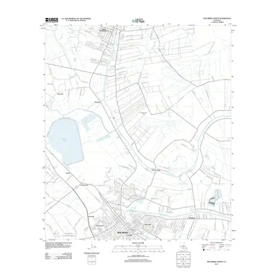
2012 Map of New Iberia North
USGS Topo · Published 2012About this map
Bayou Teche winds through the heart of the Acadiana landscape, anchoring a string of historic settlements from Saint Martinville in the north down to the northern reaches of New Iberia. This 2012 survey illustrates the transition from the densely settled bayou banks to the surrounding agricultural and industrial zones, including the Loreauville Gas Field. The map records a complex network of smaller communities like Morbihan, Coopersville, and Leesburg, many of which developed around the sugar and waterway economy of Iberia and St. Martin Parishes.
Find a feature on this map
189 named features on this map. Tap any name to fly to it.
Don’t see what you’re looking for? This feature index may not catch every label — zoom into the map to look around manually.
Map Details
Editions of this 2012 New Iberia North Map
This is the sole edition of this map. No revisions or reprints were ever made.
Other maps of this area

1937 · Jeanerette
USGS Topo · 1:62,500

1937 · Derouen
USGS Topo · 1:62,500

1939 · St. Martinsville
USGS Topo · 1:62,500

1941 · Loreauville
USGS Topo · 1:62,500

1945 · New Orleans
USGS Topo · 1:250,000

1954 · Loreauville
USGS Topo · 1:62,500

1954 · Jeanerette
USGS Topo · 1:62,500

1954 · Baton Rouge
USGS Topo · 1:250,000

1956 · Baton Rouge
USGS Topo · 1:250,000

1957 · St. Martinville
USGS Topo · 1:62,500