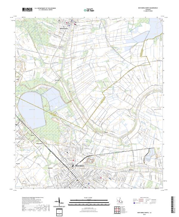
2024 Map of New Iberia North
USGS Topo · Published 2024About this map
New Iberia and St. Martinville anchor this detailed study of the Acadiana region, where the winding course of Bayou Teche defines the local geography. The map captures the transition from established urban centers to the surrounding agricultural and swamp landscapes, documenting important civic and religious landmarks such as the Saint Martin Parish Courthouse and Saint Michaels Catholic Cem. Local genealogy is well-supported by numerous burial sites, including Union Baptist Cem and Fournet Cem. Smaller named settlements like Cade, Morbihan, and Segura are scattered across the landscape, illustrating the historic settlement patterns along the bayous. The western edge is dominated by the broad expanse of Spanish Lake, while the intricate network of coulees, such as Coulee du Portage and Pointe Claire Coulee, highlights the complex hydrology of the Louisiana lowlands.
Find a feature on this map
227 named features on this map. Tap any name to fly to it.
Don’t see what you’re looking for? This feature index may not catch every label — zoom into the map to look around manually.
Map Details
Editions of this 2024 New Iberia North Map
This is the sole edition of this map. No revisions or reprints were ever made.
Other maps of this area

1937 · Jeanerette
USGS Topo · 1:62,500

1937 · Derouen
USGS Topo · 1:62,500

1939 · St. Martinsville
USGS Topo · 1:62,500

1941 · Loreauville
USGS Topo · 1:62,500

1945 · New Orleans
USGS Topo · 1:250,000

1954 · Loreauville
USGS Topo · 1:62,500

1954 · Jeanerette
USGS Topo · 1:62,500

1954 · Baton Rouge
USGS Topo · 1:250,000

1956 · Baton Rouge
USGS Topo · 1:250,000

1957 · St. Martinville
USGS Topo · 1:62,500