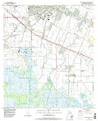
1994 Map of New Iberia South
USGS Topo · Published 1998About this map
Bayou Teche defines the northeast corner of this Cajun Country landscape, where the southern outskirts of New Iberia give way to a transition between established agricultural land and coastal marsh. The map illustrates a historic settlement pattern of sugar plantations and rural communities linked by a complex network of drainage features like Peebles Coulee and Jacks Coulee. Extensive industrial development is evident at the Port of New Iberia, which serves as a major hub for the region's commerce.
Find a feature on this map
36 named features on this map. Tap any name to fly to it.
Don’t see what you’re looking for? This feature index may not catch every label — zoom into the map to look around manually.
Map Details
Editions of this 1994 New Iberia South Map
This is the sole edition of this map. No revisions or reprints were ever made.
Other maps of this area

1937 · Jeanerette
USGS Topo · 1:62,500

1937 · Derouen
USGS Topo · 1:62,500

1939 · St. Martinsville
USGS Topo · 1:62,500

1941 · Loreauville
USGS Topo · 1:62,500

1945 · New Orleans
USGS Topo · 1:250,000

1954 · Loreauville
USGS Topo · 1:62,500

1954 · Jeanerette
USGS Topo · 1:62,500

1954 · Baton Rouge
USGS Topo · 1:250,000

1956 · Baton Rouge
USGS Topo · 1:250,000

1957 · St. Martinville
USGS Topo · 1:62,500