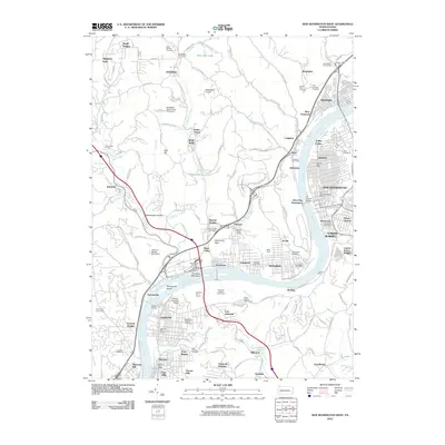
2010 Map of New Kensington West
USGS Topo · Published 2010About this map
The Allegheny River corridor defines this industrial and residential landscape, winding past a dense network of boroughs and riverfront communities. Major crossings like the C L Schmitt Bridge and Hulton Bridge connect the eastern and western banks, linking New Kensington and Arnold with towns like Creighton and Springdale. The influence of heavy industry and resource management is evident in features such as the Harmon Refuse Bank Dam and the Russellton Slurry Pond Three Dam near Russellton, reflecting the region's historical ties to manufacturing and mining.
Find a feature on this map
149 named features on this map. Tap any name to fly to it.
Don’t see what you’re looking for? This feature index may not catch every label — zoom into the map to look around manually.
Map Details
Editions of this 2010 New Kensington West Map
This is the sole edition of this map. No revisions or reprints were ever made.
Other maps of this area

1904 · Mc Keesport
USGS Topo · 1:62,500

1904 · Greensburg
USGS Topo · 1:62,500

1906 · Greensburg
USGS Topo · 1:62,500

1907 · Pittsburg
USGS Topo · 1:62,500

1907 · Freeport
USGS Topo · 1:62,500

1908 · New Kensington
USGS Topo · 1:62,500

1909 · Freeport
USGS Topo · 1:62,500

1910 · New Kensington
USGS Topo · 1:62,500

1950 · Valencia
USGS Topo · 1:24,000

1951 · Pittsburg East
USGS Topo · 1:24,000