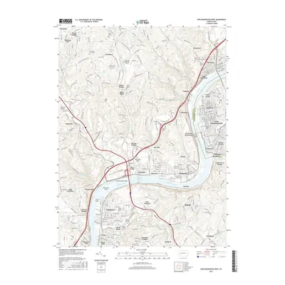
2016 Map of New Kensington West
USGS Topo · Published 2016About this map
The Allegheny River defines the corridor of this Pennsylvania landscape, winding past industrial river towns and over Fourteen Mile Island and Twelvemile Island. Settlements like Tarentum, New Kensington, and Springdale follow the river's edge, while the inland hills are marked by the complex topography of White Pine Ridge and Desperation Hollow. Transportation networks are central to the area's development, featuring the B & Le RR tracks and the Pittsburgh Northeast Airport near Russellton. Numerous burial grounds, including the Oakmont-Verona Cem, Saint Clemens Cem, and the unique Penn Forest Natural Burial Park, offer significant genealogical data. The map reveals a transition from dense riverfront communities to the more dispersed residential clusters of Harmarville and Bairdford.
Find a feature on this map
133 named features on this map. Tap any name to fly to it.
Don’t see what you’re looking for? This feature index may not catch every label — zoom into the map to look around manually.
Map Details
Editions of this 2016 New Kensington West Map
This is the sole edition of this map. No revisions or reprints were ever made.
Other maps of this area

1904 · Mc Keesport
USGS Topo · 1:62,500

1904 · Greensburg
USGS Topo · 1:62,500

1906 · Greensburg
USGS Topo · 1:62,500

1907 · Pittsburg
USGS Topo · 1:62,500

1907 · Freeport
USGS Topo · 1:62,500

1908 · New Kensington
USGS Topo · 1:62,500

1909 · Freeport
USGS Topo · 1:62,500

1910 · New Kensington
USGS Topo · 1:62,500

1950 · Valencia
USGS Topo · 1:24,000

1951 · Pittsburg East
USGS Topo · 1:24,000