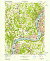
1953 Map of New Kensington West
USGS Topo · Published 1955About this map
The Allegheny River defines the industrial and residential development of this region, separating New Kensington and Arnold on the eastern bank from the dense network of boroughs on the west. In the mid-1950s, the river serves as a primary transit and power corridor, anchored by Lock and Dam No 3 and the New Kensington Bridge. The landscape is a complex mix of heavy industry and suburban expansion, where the Russellton Mine and various strip mines sit alongside established communities like Springdale and Oakmont.
Find a feature on this map
111 named features on this map. Tap any name to fly to it.
Don’t see what you’re looking for? This feature index may not catch every label — zoom into the map to look around manually.
Map Details
Editions of this 1953 New Kensington West Map
This is the sole edition of this map. No revisions or reprints were ever made.
Other maps of this area

1904 · Mc Keesport
USGS Topo · 1:62,500

1904 · Greensburg
USGS Topo · 1:62,500

1906 · Greensburg
USGS Topo · 1:62,500

1907 · Pittsburg
USGS Topo · 1:62,500

1907 · Freeport
USGS Topo · 1:62,500

1908 · New Kensington
USGS Topo · 1:62,500

1909 · Freeport
USGS Topo · 1:62,500

1910 · New Kensington
USGS Topo · 1:62,500

1950 · Valencia
USGS Topo · 1:24,000

1951 · Pittsburg East
USGS Topo · 1:24,000