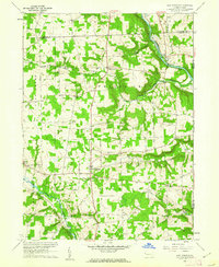
1960 Map of New Lebanon
USGS Topo · Published 1962About this map
French Creek carves a deep valley through the northern landscape of this region, providing a natural corridor for the Erie-Lackawanna railroad as it passes through the small settlement of Carlton. The area is characterized by a network of scattered rural communities including Milledgeville, New Lebanon, and New Vernon, each serving as local centers for the surrounding farmsteads. Genealogists will find significant local history preserved at sites like Milledgeville Cem, New Lebanon Cem, and the Boyd Cem. The presence of several country houses of worship, such as Deer Creek Ch and Fairfield Ch, reflects the community structure of the mid-20th century. To the south, the terrain descends toward Sandy Lake, while infrastructure like a Gas Well and an Airway Beacon points to the industrial and navigational needs of the era.
Find a feature on this map
35 named features on this map. Tap any name to fly to it.
Don’t see what you’re looking for? This feature index may not catch every label — zoom into the map to look around manually.
Map Details
Editions of this 1960 New Lebanon Map
3 editions found
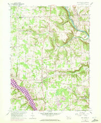
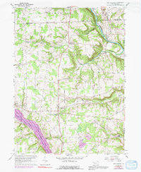
Other maps of this area

1909 · Franklin
USGS Topo · 1:62,500

1911 · Franklin
USGS Topo · 1:62,500

1911 · Stoneboro
USGS Topo · 1:62,500

1913 · Stoneboro
USGS Topo · 1:62,500

1923 · Meadville
USGS Topo · 1:62,500

1925 · Meadville
USGS Topo · 1:62,500

1927 · Townville
USGS Topo · 1:48,000

1932 · Townville
USGS Topo · 1:62,500

1943 · Meadville
USGS Topo · 1:62,500

1943 · Stoneboro
USGS Topo · 1:62,500
Featured Places
- New Vernon Township, PA
- New Lebanon, PA
- Wayne Township, PA
- Deer Creek Township, PA
- Frenchcreek Township, PA