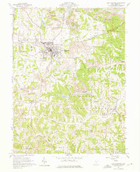
1961 Map of New Lexington
USGS Topo · Published 1975About this map
New Lexington serves as the focal point of this early 1960s survey, showing a landscape defined by industrial extraction and rail transport. The community is a junction for several major lines, including the Pennsylvania, New York Central, and Baltimore and Ohio railroads. These routes serviced the extensive Strip Mine operations and numerous Mines that pockmark the surrounding ridges, particularly throughout Pike and Bristol townships.
Find a feature on this map
63 named features on this map. Tap any name to fly to it.
Don’t see what you’re looking for? This feature index may not catch every label — zoom into the map to look around manually.
Map Details
Editions of this 1961 New Lexington Map
4 editions found
Other maps of this area

1907 · Logan
USGS Topo · 1:62,500

1909 · Thornville
USGS Topo · 1:62,500

1909 · Logan
USGS Topo · 1:62,500

1910 · Zanesville
USGS Topo · 1:62,500

1911 · New Lexington
USGS Topo · 1:62,500

1947 · Columbus
USGS Topo · 1:250,000

1961 · Columbus
USGS Topo · 1:250,000

1961 · Corning
USGS Topo · 1:24,000

1961 · New Lexington
USGS Topo · 1:24,000

1961 · Deavertown
USGS Topo · 1:24,000