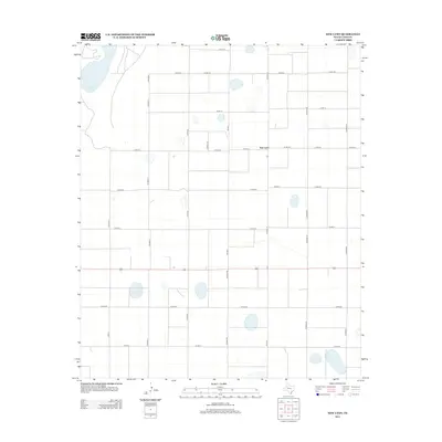
2012 Map of New Lynn
USGS Topo · Published 2012About this map
New Lynn stands as the primary namesake settlement in this High Plains region of Lynn County, where the landscape is defined by a grid of agricultural thoroughfares and intermittent water bodies. The terrain features numerous small, seasonal basins, most notably the edge of Tahoka Lake in the northwest corner, which punctuates the flat, productive acreage of the Llano Estacado. A network of rural routes, including Fm-1054 and an extensive system of county roads such as Co Road Y and Co Road Z, facilitates the movement of local agricultural goods. This survey reflects the enduring rural character of the area in the early twenty-first century, showing how modern land management follows the historic sectional lines established by early surveyors. The sparse distribution of named points highlights the concentrated nature of local farming communities in this part of Texas.
Find a feature on this map
23 named features on this map. Tap any name to fly to it.
Don’t see what you’re looking for? This feature index may not catch every label — zoom into the map to look around manually.
Map Details
Editions of this 2012 New Lynn Map
This is the sole edition of this map. No revisions or reprints were ever made.
Other maps of this area

1954 · Lubbock
USGS Topo · 1:250,000

1957 · New Home
USGS Topo · 1:62,500

1965 · Southland
USGS Topo · 1:24,000

1965 · Wilson
USGS Topo · 1:24,000

1969 · Skeen Lake
USGS Topo · 1:24,000

1969 · Tahoka
USGS Topo · 1:24,000

1969 · Grassland SE
USGS Topo · 1:24,000

1970 · New Lynn
USGS Topo · 1:24,000
1970 · Draw
USGS Topo · 1:24,000

1970 · Grassland
USGS Topo · 1:24,000