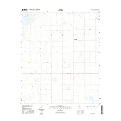
2016 Map of New Lynn
USGS Topo · Published 2016About this map
New Lynn stands as the central settlement in this portion of the Texas High Plains, surrounded by an orderly grid of county roads that define the local agricultural landscape. The terrain is characterized by subtle elevation changes and numerous depressions, the most prominent being the large expanse of Tahoka Lake in the northwest corner. This saline playa is a significant geographic landmark in Lynn County, reflecting the unique hydrology of the Llano Estacado.
Find a feature on this map
18 named features on this map. Tap any name to fly to it.
Don’t see what you’re looking for? This feature index may not catch every label — zoom into the map to look around manually.
Map Details
Editions of this 2016 New Lynn Map
This is the sole edition of this map. No revisions or reprints were ever made.
Other maps of this area

1954 · Lubbock
USGS Topo · 1:250,000

1957 · New Home
USGS Topo · 1:62,500

1965 · Southland
USGS Topo · 1:24,000

1965 · Wilson
USGS Topo · 1:24,000

1969 · Skeen Lake
USGS Topo · 1:24,000

1969 · Tahoka
USGS Topo · 1:24,000

1969 · Grassland SE
USGS Topo · 1:24,000

1970 · New Lynn
USGS Topo · 1:24,000
1970 · Draw
USGS Topo · 1:24,000

1970 · Grassland
USGS Topo · 1:24,000