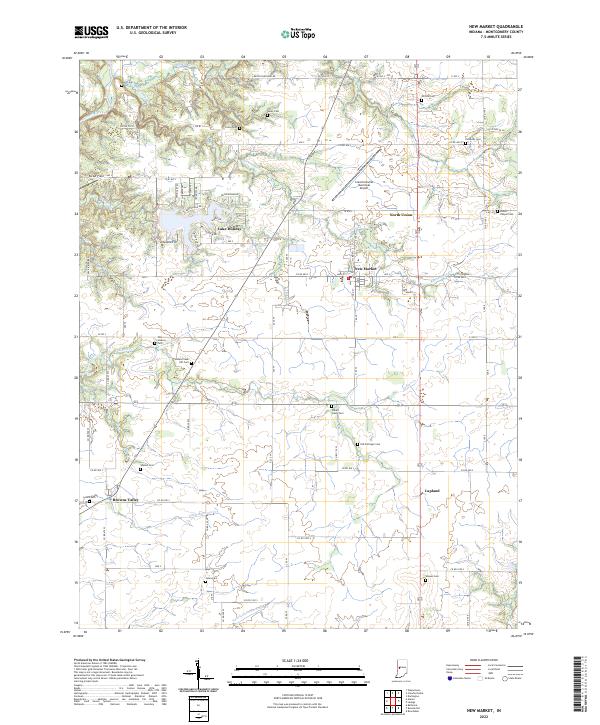
2022 Map of New Market
USGS Topo · Published 2022About this map
The town of New Market serves as the central hub of this Montgomery County landscape, situated at the intersection of a grid-based rural road network and the natural drainage of Rattlesnake Creek. To the west, the residential development around Lake Holiday presents a distinct suburban contrast to the surrounding agricultural sections, with streets like Seminole Trail and Arrowhead Drive reflecting late-20th-century expansion. The map is particularly notable for its high density of family and community burial grounds, preserving the locations of early area homesteads through sites such as Old Pottinger Cemetery and Finley Chapel Cemetery. Small settlements like Browns Valley, Lapland, and North Union dot the region, while the Crawfordsville Municipal Airport occupies the northern reaches. The terrain is defined by the winding paths of Indian Creek and Little Raccoon Creek, which carve through the till plains of Indiana.
Find a feature on this map
65 named features on this map. Tap any name to fly to it.
Don’t see what you’re looking for? This feature index may not catch every label — zoom into the map to look around manually.
Map Details
Editions of this 2022 New Market Map
This is the sole edition of this map. No revisions or reprints were ever made.
Other maps of this area

1949 · Alamo
USGS Topo · 1:24,000

1953 · Danville
USGS Topo · 1:250,000

1953 · Indianapolis
USGS Topo · 1:250,000

1955 · Danville
USGS Topo · 1:250,000

1955 · Russellville
USGS Topo · 1:24,000

1956 · Danville
USGS Topo · 1:250,000

1956 · Indianapolis
USGS Topo · 1:250,000

1956 · Crawfordsville
USGS Topo · 1:24,000

1956 · New Market
USGS Topo · 1:24,000

1957 · Indianapolis
USGS Topo · 1:250,000