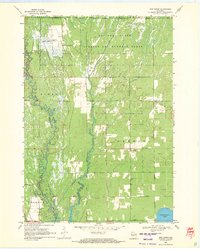
1969 Map of New Miner
USGS Topo · Published 1971About this map
The Yellow River and Cranberry Creek dominate this Central Wisconsin landscape, where military training grounds meet a conservation wilderness. The northern reach is defined by the National Guard Bombing and Gunnery Range, marked by a series of firebreaks and an Observation Tower. To the south, the terrain transitions into the Necedah National Wildlife Refuge, showcasing the region's complex water management through various drainage ditches and a grid of rural roads like 9th Street.
Find a feature on this map
30 named features on this map. Tap any name to fly to it.
Don’t see what you’re looking for? This feature index may not catch every label — zoom into the map to look around manually.
Map Details
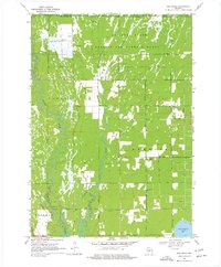
Editions of this 1969 New Miner Map
2 editions found
Other maps of this area

1953 · Eau Claire
USGS Topo · 1:250,000

1955 · Green Bay
USGS Topo · 1:250,000

1957 · Wisconsin Rapids
USGS Topo · 1:48,000

1957 · Pittsville
USGS Topo · 1:48,000

1958 · Eau Claire
USGS Topo · 1:250,000

1958 · Arkdale
USGS Topo · 1:48,000

1958 · Necedah
USGS Topo · 1:48,000

1964 · Eau Claire
USGS Topo · 1:250,000

1967 · Wisconsin Rapids
USGS Topo · 1:62,500

1967 · Pittsville
USGS Topo · 1:62,500