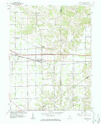
1961 Map of New Point
USGS Topo · Published 1963About this map
The town of New Point serves as a central hub in this early 1960s landscape, situated where the New York Central railroad corridor bisects rural Decatur and Franklin Counties. This survey captures a network of small agricultural crossroads settlements, including St Maurice, Enochsburg, and New Pennington, during a period of transition as modern infrastructure was overlaid upon established farmsteads. South of Rossburg, several Quarries indicate the local extractive industry, while a Covered Bridge east of Enochsburg remains a prominent landmark from an earlier era.
Find a feature on this map
52 named features on this map. Tap any name to fly to it.
Don’t see what you’re looking for? This feature index may not catch every label — zoom into the map to look around manually.
Map Details
Editions of this 1961 New Point Map
4 editions found
Other maps of this area

1946 · Pierceville
USGS Topo · 1:24,000

1946 · Batesville
USGS Topo · 1:24,000

1946 · Osgood
USGS Topo · 1:24,000

1946 · New Point
USGS Topo · 1:24,000

1953 · Cincinnati
USGS Topo · 1:250,000

1956 · Metamora
USGS Topo · 1:24,000

1957 · Cincinnati
USGS Topo · 1:250,000

1958 · Greensburg
USGS Topo · 1:24,000

1958 · Millhousen
USGS Topo · 1:24,000

1958 · Clarksburg
USGS Topo · 1:24,000