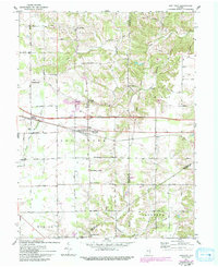
1961 Map of New Point
USGS Topo · Published 1993About this map
New Point serves as a central hub in this corner of southeastern Indiana, where the Conrail line and Interstate highway system cross the fertile landscape. The map details a transition from the rolling timbered ridges along Salt Creek and the Righthand Fork in the north to the more level agricultural plains of Marion and Salt Creek townships. Genealogists and local historians will find significant data in the numerous family and community landmarks, including Zion Ch, Maple Cem, and the small cluster at Rossburg.
Find a feature on this map
47 named features on this map. Tap any name to fly to it.
Don’t see what you’re looking for? This feature index may not catch every label — zoom into the map to look around manually.
Map Details
Editions of this 1961 New Point Map
4 editions found
Other maps of this area

1946 · Pierceville
USGS Topo · 1:24,000

1946 · Batesville
USGS Topo · 1:24,000

1946 · Osgood
USGS Topo · 1:24,000

1946 · New Point
USGS Topo · 1:24,000

1953 · Cincinnati
USGS Topo · 1:250,000

1956 · Metamora
USGS Topo · 1:24,000

1957 · Cincinnati
USGS Topo · 1:250,000

1958 · Greensburg
USGS Topo · 1:24,000

1958 · Millhousen
USGS Topo · 1:24,000

1958 · Clarksburg
USGS Topo · 1:24,000