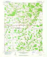
1961 Map of New Point
USGS Topo · Published 1963About this map
New Point serves as the central hub of this Indiana landscape, situated where the New York Central railroad bisects the countryside. The rail corridor connects smaller rural nodes like Rossburg and Smiths Crossing, while a network of regional roads links surrounding agricultural communities such as St Maurice, Enochsburg, and New Pennington. The terrain is defined by the dendritic drainage patterns of Salt Creek and the Vernon Fork of the Muscatatuck River, which cut through the level farmland.
Find a feature on this map
32 named features on this map. Tap any name to fly to it.
Don’t see what you’re looking for? This feature index may not catch every label — zoom into the map to look around manually.
Map Details
Editions of this 1961 New Point Map
4 editions found
Other maps of this area

1946 · Pierceville
USGS Topo · 1:24,000

1946 · Batesville
USGS Topo · 1:24,000

1946 · Osgood
USGS Topo · 1:24,000

1946 · New Point
USGS Topo · 1:24,000

1953 · Cincinnati
USGS Topo · 1:250,000

1956 · Metamora
USGS Topo · 1:24,000

1957 · Cincinnati
USGS Topo · 1:250,000

1958 · Greensburg
USGS Topo · 1:24,000

1958 · Millhousen
USGS Topo · 1:24,000

1958 · Clarksburg
USGS Topo · 1:24,000