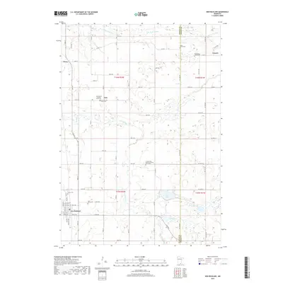
2019 Map of New Richland
USGS Topo · Published 2019About this map
The town of New Richland anchors this South-Central Minnesota landscape, situated where the fertile prairie meets a complex system of glacial wetlands and watercourses. The drainage patterns of the Le Sueur River and the Little Le Sueur River wind across the terrain, shaping the development of rural clusters like Otisco, Vista, and Lemond. This map highlights a significant density of early Scandinavian and German heritage, evidenced by numerous faith-based sites including the Vista Swedish Lutheran Church and the Le Sueur River American Lutheran Church Cem.
Find a feature on this map
28 named features on this map. Tap any name to fly to it.
Don’t see what you’re looking for? This feature index may not catch every label — zoom into the map to look around manually.
Map Details
Editions of this 2019 New Richland Map
This is the sole edition of this map. No revisions or reprints were ever made.
Other maps of this area

1953 · Saint Paul
USGS Topo · 1:250,000

1954 · Mason City
USGS Topo · 1:250,000

1957 · Mason City
USGS Topo · 1:250,000

1958 · Mason City
USGS Topo · 1:250,000

1959 · Saint Paul
USGS Topo · 1:250,000

1962 · Saco
USGS Topo · 1:24,000

1962 · Meriden
USGS Topo · 1:24,000

1966 · Waseca
USGS Topo · 1:24,000

1967 · Freeborn
USGS Topo · 1:24,000
1967 · Otisco
USGS Topo · 1:24,000