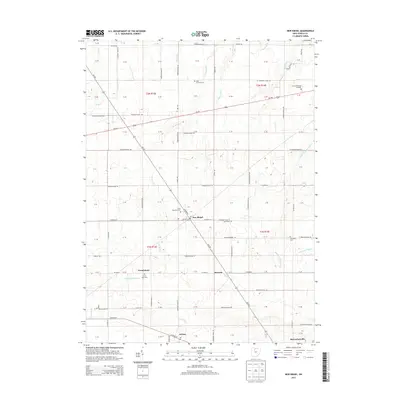
2013 Map of New Riegel
USGS Topo · Published 2013About this map
New Riegel sits at the intersection of a vast grid of section roads and township lines in this portion of Seneca County. The agricultural landscape is punctuated by several small hamlets, including Frenchtown, Berwick, and Adrian, which reflect the early settlement patterns of the region. A notable concentration of religious and genealogical sites is evident, from Saint Boniface Cem in New Riegel to the Jerusalem Cem further east. The drainage of these flat farm lands is managed by an intricate network of ditches and creeks, such as E Br Wolf Cr and Eicher Ditch, which feed into larger water systems. To the west of Frenchtown, the Greenwich Reservoir provides a localized water source, while McCutchenville appears at the southern edge of the survey area. This record provides a clear view of the rural infrastructure, showing how modern county roads like Co Road 10 follow the historic township and range boundaries established long ago.
Find a feature on this map
109 named features on this map. Tap any name to fly to it.
Don’t see what you’re looking for? This feature index may not catch every label — zoom into the map to look around manually.
Map Details
Editions of this 2013 New Riegel Map
This is the sole edition of this map. No revisions or reprints were ever made.
Other maps of this area

1901 · Fostoria
USGS Topo · 1:62,500

1903 · Fostoria
USGS Topo · 1:62,500

1906 · Sycamore
USGS Topo · 1:62,500

1906 · Tiffin
USGS Topo · 1:62,500

1907 · Upper Sandusky
USGS Topo · 1:62,500

1950 · Marion
USGS Topo · 1:250,000

1956 · Toledo
USGS Topo · 1:250,000

1960 · Sycamore
USGS Topo · 1:24,000

1960 · Tiffin South
USGS Topo · 1:24,000
1960 · Bascom
USGS Topo · 1:24,000