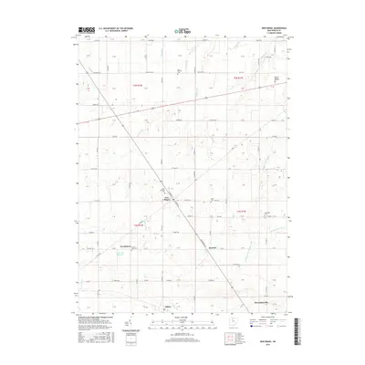
2016 Map of New Riegel
USGS Topo · Published 2016About this map
New Riegel sits at the heart of this Seneca County landscape, reflecting the agricultural and ecclesiastical heritage of Big Spring Township. The area is defined by a dense network of country roads and several prominent parish cemeteries, including Saint Boniface Cem and Saint Patricks Cem. This 2016 survey illustrates the persistent rural character of the region, where small hamlets like Frenchtown and Berwick remain distinct nodes within the sprawling farmland. Water management is a visible priority here, as seen in the engineered paths of Staub Ditch and Hepp Ditch that coordinate with natural waterways like Wolf Cr. The presence of the Greenwich Reservoir and various family-named burial grounds like Reisz Cem provides valuable points of interest for those tracing local land use and genealogical history in northwestern Ohio.
Find a feature on this map
77 named features on this map. Tap any name to fly to it.
Don’t see what you’re looking for? This feature index may not catch every label — zoom into the map to look around manually.
Map Details
Editions of this 2016 New Riegel Map
This is the sole edition of this map. No revisions or reprints were ever made.
Other maps of this area

1901 · Fostoria
USGS Topo · 1:62,500

1903 · Fostoria
USGS Topo · 1:62,500

1906 · Sycamore
USGS Topo · 1:62,500

1906 · Tiffin
USGS Topo · 1:62,500

1907 · Upper Sandusky
USGS Topo · 1:62,500

1950 · Marion
USGS Topo · 1:250,000

1956 · Toledo
USGS Topo · 1:250,000

1960 · Sycamore
USGS Topo · 1:24,000

1960 · Tiffin South
USGS Topo · 1:24,000
1960 · Bascom
USGS Topo · 1:24,000