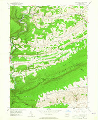
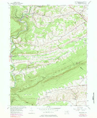
1956 Map of New Ringgold
USGS Topo · Published 1965About this map
Blue Mountain and the prominent Hawk Mountain Sanctuary dominate this mid-century landscape where Schuylkill, Berks, and Lehigh counties converge. The rugged ridgeline is traversed by the Appalachian Trail, passing landmarks such as Dans Pulpit and looking down upon the River of Rocks. Below the slopes, the Little Schuylkill River and the Reading railroad corridor support a network of small valley settlements including New Ringgold, Hecla, and Kepner.
Find a feature on this map
56 named features on this map. Tap any name to fly to it.
Don’t see what you’re looking for? This feature index may not catch every label — zoom into the map to look around manually.
Map Details
Editions of this 1956 New Ringgold Map
6 editions found

Other maps of this area

1889 · Hazleton
USGS Topo · 1:62,500

1889 · Pottsville
USGS Topo · 1:62,500

1891 · Hazleton
USGS Topo · 1:62,500

1891 · Pottsville
USGS Topo · 1:62,500

1892 · Mahanoy
USGS Topo · 1:62,500

1893 · Hazleton
USGS Topo · 1:62,500

1893 · Mahanoy
USGS Topo · 1:62,500

1909 · Hamburg
USGS Topo · 1:62,500

1911 · Hamburg
USGS Topo · 1:62,500

1944 · Orwigsburg
USGS Topo · 1:24,000
Featured Places
- West Penn Township, PA
- Albany Township, PA
- New Ringgold, PA
- Kepner, West Penn Township
- West Brunswick Township, PA