
1952 Map of New River Inlet
USGS Topo · Published 1955About this map
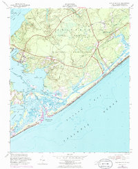
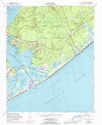
Camp Lejeune Military Reservation dominates this coastal landscape, showing the mid-century infrastructure of the Marine Corps installation along the New River and the Atlantic coast. The map details the transition from small settlements like Peru and Marines to a high-density military area, complete with a Landing Strip, a Fire Tower, and tactical landmarks like Courthouse Bay. The intricate coastal geography is the defining feature here, where the Intracoastal Waterway threads behind barrier islands and through complex sound systems.
Find a feature on this map
48 named features on this map. Tap any name to fly to it.
Don’t see what you’re looking for? This feature index may not catch every label — zoom into the map to look around manually.
Map Details
Editions of this 1952 New River Inlet Map
4 editions found

Other maps of this area

1942 · Spicer Bay
USGS Topo · 1:62,500

1942 · Swansboro
USGS Topo · 1:62,500

1948 · Swansboro
USGS Topo · 1:62,500

1948 · New River
USGS Topo · 1:62,500

1952 · Hubert
USGS Topo · 1:24,000

1952 · Camp Lejeune
USGS Topo · 1:24,000

1952 · Jacksonville South
USGS Topo · 1:24,000

1952 · Browns Inlet
USGS Topo · 1:24,000

1952 · Spicer Bay
USGS Topo · 1:24,000

1952 · Sneads Ferry
USGS Topo · 1:24,000
Featured Places
- North Topsail Beach, NC
- Marine Corps Base Camp Lejeune, NC
- Peru, NC
- Chadwick Acres, NC
- Duck Creek, Marine Corps Base Camp Lejeune