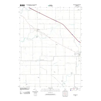
2010 Map of New Ross
USGS Topo · Published 2010About this map
New Ross and Jamestown anchor this central Indiana landscape, where a dense grid of rural roads connects several small settlements and numerous family burial grounds. The terrain is defined by the winding paths of Big Raccoon Creek, Little Raccoon Creek, and Big Walnut Creek, which create natural breaks in the geometric agricultural layout. The prevalence of small, scattered graveyards such as Brown Cemetery, Porter Cemetery, and the Kidd Farm Cemetery offers significant value for genealogists tracking early inhabitants of Boone and Montgomery counties.
Find a feature on this map
48 named features on this map. Tap any name to fly to it.
Don’t see what you’re looking for? This feature index may not catch every label — zoom into the map to look around manually.
Map Details
Editions of this 2010 New Ross Map
This is the sole edition of this map. No revisions or reprints were ever made.
Other maps of this area

1953 · Lizton
USGS Topo · 1:24,000

1953 · Danville
USGS Topo · 1:24,000

1953 · Danville
USGS Topo · 1:250,000

1953 · Indianapolis
USGS Topo · 1:250,000

1955 · Danville
USGS Topo · 1:250,000

1956 · Danville
USGS Topo · 1:250,000

1956 · Indianapolis
USGS Topo · 1:250,000

1957 · Indianapolis
USGS Topo · 1:250,000

1957 · New Ross
USGS Topo · 1:24,000

1958 · Darlington
USGS Topo · 1:24,000