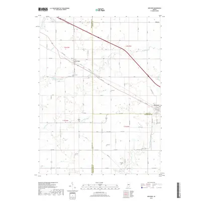
2019 Map of New Ross
USGS Topo · Published 2019About this map
New Ross sits at the intersection of several significant local routes and watercourses in this west-central Indiana landscape. The settlement's layout is closely tied to the diagonal path of the regional thoroughfare, where State St and New Ross Rd meet. The surrounding agricultural land is drained by a network of waterways, including Big Raccoon Creek, Cornstalk Cr, and Walnut Fork Sugar Creek to the north. These streams define the rolling topography between the larger hubs of Jamestown and Advance.
Find a feature on this map
79 named features on this map. Tap any name to fly to it.
Don’t see what you’re looking for? This feature index may not catch every label — zoom into the map to look around manually.
Map Details
Editions of this 2019 New Ross Map
This is the sole edition of this map. No revisions or reprints were ever made.
Other maps of this area

1953 · Lizton
USGS Topo · 1:24,000

1953 · Danville
USGS Topo · 1:24,000

1953 · Danville
USGS Topo · 1:250,000

1953 · Indianapolis
USGS Topo · 1:250,000

1955 · Danville
USGS Topo · 1:250,000

1956 · Danville
USGS Topo · 1:250,000

1956 · Indianapolis
USGS Topo · 1:250,000

1957 · Indianapolis
USGS Topo · 1:250,000

1957 · New Ross
USGS Topo · 1:24,000

1958 · Darlington
USGS Topo · 1:24,000