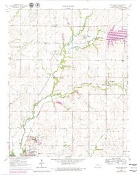
1965 Map of New Salem
USGS Topo · Published 1979About this map
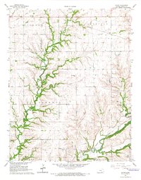
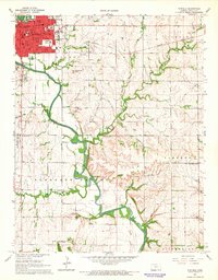
Winfield State Hospital and the campus of Southwestern College anchor the southwestern corner of this Kansas landscape, where the urban edge of Winfield meets the agricultural and industrial expanse of Cowley County. The terrain is defined by a dense network of energy extraction, including the Winfield Oil Field and Frog Hollow Field, with dozens of wells scattered across the prairie. This mid-century view captures the area just as Timber Creek Lake was established, altering the flow of Timber Creek and its many tributaries like Dutch Creek and Cedar Creek. The Atchison Topeka and Santa Fe railroad serves as a primary transit corridor, connecting the small community of New Salem to the larger regional centers. Smaller rural landmarks, such as Sunnyside Sch and Union Cem, reveal the older patterns of settlement that persist amidst the evolving oil economy.
Find a feature on this map
33 named features on this map. Tap any name to fly to it.
Don’t see what you’re looking for? This feature index may not catch every label — zoom into the map to look around manually.
Map Details
Editions of this 1965 New Salem Map
2 editions found

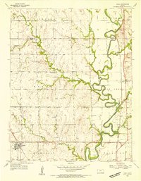
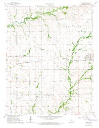
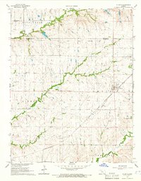
Other maps of this area

1889 · Burden
USGS Topo · 1:125,000

1890 · Wellington
USGS Topo · 1:125,000
1955 · Udall
USGS Topo · 1:24,000

1955 · Wichita
USGS Topo · 1:250,000

1958 · Wichita
USGS Topo · 1:250,000
1964 · Burden
USGS Topo · 1:24,000
1964 · Atlanta
USGS Topo · 1:24,000
1965 · Eaton
USGS Topo · 1:24,000
1965 · Winfield
USGS Topo · 1:24,000
1965 · Wilmot
USGS Topo · 1:24,000