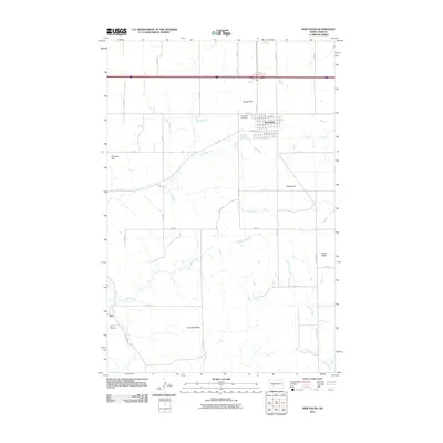
2011 Map of New Salem
USGS Topo · Published 2011About this map
The town of New Salem anchors this portion of Morton County, North Dakota, appearing as a compact grid of residential streets like Birch Ave and Spruce Ave situated just south of the interstate. The landscape is characterized by a series of prominent elevations and ridges that overlook a winding drainage network. Notable high points include School Hill and Gaebe Hill to the east, while Klondike Butte and Rocky Ridge dominate the southern reaches.
Find a feature on this map
29 named features on this map. Tap any name to fly to it.
Don’t see what you’re looking for? This feature index may not catch every label — zoom into the map to look around manually.
Map Details
Editions of this 2011 New Salem Map
This is the sole edition of this map. No revisions or reprints were ever made.
Other maps of this area

1954 · Bismarck
USGS Topo · 1:250,000

1958 · Bismarck
USGS Topo · 1:250,000

1960 · North Almont
USGS Topo · 1:24,000

1960 · New Salem
USGS Topo · 1:24,000

1970 · Bluegrass
USGS Topo · 1:24,000

1970 · New Salem NW
USGS Topo · 1:24,000

1970 · Judson
USGS Topo · 1:24,000

1970 · New Salem NE
USGS Topo · 1:24,000

1980 · Green Ridge
USGS Topo · 1:24,000

1980 · Almont East
USGS Topo · 1:24,000