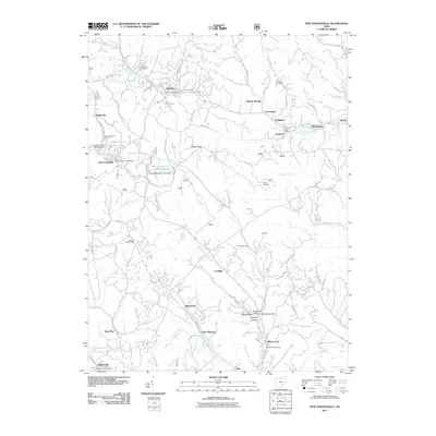
2011 Map of New Straitsville
USGS Topo · Published 2011About this map
New Straitsville and the surrounding Perry County landscape are defined by a network of hollows and small settlements that once powered Ohio's coal and clay industries. The terrain is marked by significant topographical relief, with prominent features like Dugan Ridge and the Shawnee Lookout Tower overlooking a patchwork of drainage systems, including Monday Creek and Brush Fork. The area’s coal-mining legacy is subtly preserved in the names of clusters like Coalgate, Blatchford, and Carbon Hill.
Find a feature on this map
52 named features on this map. Tap any name to fly to it.
Don’t see what you’re looking for? This feature index may not catch every label — zoom into the map to look around manually.
Map Details
Editions of this 2011 New Straitsville Map
This is the sole edition of this map. No revisions or reprints were ever made.
Other maps of this area

1903 · Athens
USGS Topo · 1:62,500

1904 · Zaleski
USGS Topo · 1:62,500

1905 · Athens
USGS Topo · 1:62,500

1907 · Zaleski
USGS Topo · 1:62,500

1907 · Logan
USGS Topo · 1:62,500

1909 · Logan
USGS Topo · 1:62,500

1911 · New Lexington
USGS Topo · 1:62,500

1947 · Columbus
USGS Topo · 1:250,000

1961 · Columbus
USGS Topo · 1:250,000

1961 · Nelsonville
USGS Topo · 1:24,000