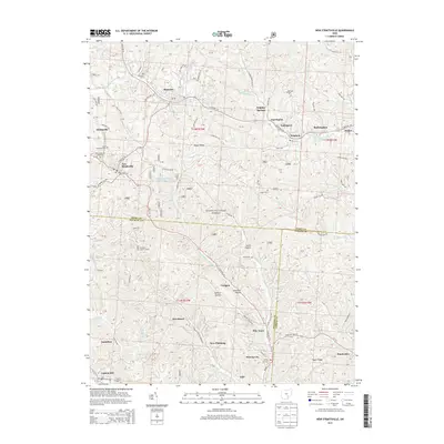
2013 Map of New Straitsville
USGS Topo · Published 2013About this map
New Straitsville and Shawnee anchor this detailed study of the Hocking Valley coal region, where deep hollows and high ridges dictate the settlement pattern. The landscape is defined by the intersection of industrial history and protected woodlands, with much of the terrain falling within the Wayne National Forest. Narrow valleys house a sequence of small communities like New Pittsburg, Jobs, and Murray City, connected by winding routes such as State Rte 216.
Find a feature on this map
69 named features on this map. Tap any name to fly to it.
Don’t see what you’re looking for? This feature index may not catch every label — zoom into the map to look around manually.
Map Details
Editions of this 2013 New Straitsville Map
This is the sole edition of this map. No revisions or reprints were ever made.
Other maps of this area

1903 · Athens
USGS Topo · 1:62,500

1904 · Zaleski
USGS Topo · 1:62,500

1905 · Athens
USGS Topo · 1:62,500

1907 · Zaleski
USGS Topo · 1:62,500

1907 · Logan
USGS Topo · 1:62,500

1909 · Logan
USGS Topo · 1:62,500

1911 · New Lexington
USGS Topo · 1:62,500

1947 · Columbus
USGS Topo · 1:250,000

1961 · Columbus
USGS Topo · 1:250,000

1961 · Nelsonville
USGS Topo · 1:24,000