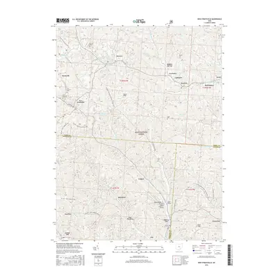
2016 Map of New Straitsville
USGS Topo · Published 2016About this map
New Straitsville and Shawnee sit at the center of this terrain where the borders of Perry, Hocking, and Athens counties converge. The landscape is defined by the dense forest cover of the Wayne National Forest and a series of ridges, including Dugan Ridge and Taylor Ridge, that separate the winding creek valleys. Small settlements like Murray City, Carbon Hill, and Coalgate are connected by a network of local roads and recreational corridors such as the N Country National Scenic Trail (Buckeye Trail). For genealogists, the map is particularly useful for locating several rural burial grounds, including the New Straitsville Joint Cem, Salem Cem, and Saint Augustines Cem. These scattered settlements and cemeteries reflect the region's long history of small-town coal mining and forestry, with many place names like Blatchford and Jobs marking the locations of former industrial sites along the banks of the Snow Fork and Middle Fork Snow Fork.
Find a feature on this map
58 named features on this map. Tap any name to fly to it.
Don’t see what you’re looking for? This feature index may not catch every label — zoom into the map to look around manually.
Map Details
Editions of this 2016 New Straitsville Map
This is the sole edition of this map. No revisions or reprints were ever made.
Other maps of this area

1903 · Athens
USGS Topo · 1:62,500

1904 · Zaleski
USGS Topo · 1:62,500

1905 · Athens
USGS Topo · 1:62,500

1907 · Zaleski
USGS Topo · 1:62,500

1907 · Logan
USGS Topo · 1:62,500

1909 · Logan
USGS Topo · 1:62,500

1911 · New Lexington
USGS Topo · 1:62,500

1947 · Columbus
USGS Topo · 1:250,000

1961 · Columbus
USGS Topo · 1:250,000

1961 · Nelsonville
USGS Topo · 1:24,000