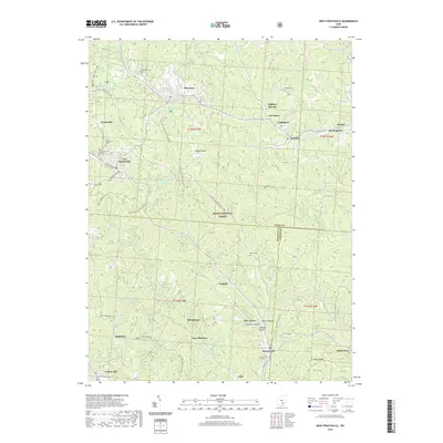
2019 Map of New Straitsville
USGS Topo · Published 2019About this map
New Straitsville and the surrounding coal-country settlements of Shawnee and Murray City anchor this 2019 survey of the Hocking Valley region. The landscape is defined by the dense forest cover of the Wayne National Forest, which encompasses nearly the entire quadrangle and is woven with recreation paths like the N Country National Scenic Trail and the Main Corridor Trail. Many smaller named locales and former mining centers like Blatchford, New Pittsburg, and Carbon Hill dot the terrain, reflecting the area's deep industrial roots.
Find a feature on this map
55 named features on this map. Tap any name to fly to it.
Don’t see what you’re looking for? This feature index may not catch every label — zoom into the map to look around manually.
Map Details
Editions of this 2019 New Straitsville Map
This is the sole edition of this map. No revisions or reprints were ever made.
Other maps of this area

1903 · Athens
USGS Topo · 1:62,500

1904 · Zaleski
USGS Topo · 1:62,500

1905 · Athens
USGS Topo · 1:62,500

1907 · Zaleski
USGS Topo · 1:62,500

1907 · Logan
USGS Topo · 1:62,500

1909 · Logan
USGS Topo · 1:62,500

1911 · New Lexington
USGS Topo · 1:62,500

1947 · Columbus
USGS Topo · 1:250,000

1961 · Columbus
USGS Topo · 1:250,000

1961 · Nelsonville
USGS Topo · 1:24,000