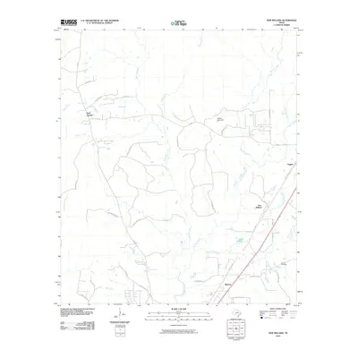
2010 Map of New Willard
USGS Topo · Published 2010About this map
New Willard and Leggett anchor the eastern corridor of this Polk County landscape, which is defined by a dense network of watercourses and family-named rural roads. The terrain is deeply etched by Long King Creek and Long Tom Creek, which drain toward the south, while Sandy Creek and Manton Creek carve through the western reaches. This 2010 survey captures a region where the traditional rural settlement patterns remain visible through scattered sites like Bold Springs and the small community of Marston.
Find a feature on this map
43 named features on this map. Tap any name to fly to it.
Don’t see what you’re looking for? This feature index may not catch every label — zoom into the map to look around manually.
Map Details
Editions of this 2010 New Willard Map
This is the sole edition of this map. No revisions or reprints were ever made.
Other maps of this area

1954 · Beaumont
USGS Topo · 1:250,000

1955 · New Willard
USGS Topo · 1:62,500

1957 · Beaumont
USGS Topo · 1:250,000

1958 · Livingston
USGS Topo · 1:62,500

1960 · Blanchard
USGS Topo · 1:24,000

1960 · Colita
USGS Topo · 1:24,000

1961 · Onalaska
USGS Topo · 1:24,000

1984 · Soda
USGS Topo · 1:24,000

1984 · Beaumont
USGS Topo · 1:250,000
1984 · Livingston
USGS Topo · 1:24,000