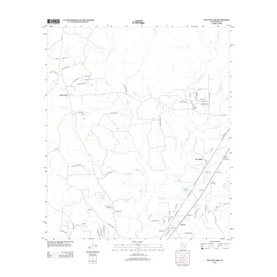
2013 Map of New Willard
USGS Topo · Published 2013About this map
New Willard and the surrounding piney woods of Polk County are defined by a complex network of creeks and small family-named settlements. The landscape is heavily dissected by waterways like Long King Cr, Long Tom Cr, and Alexander Cr, which likely shaped the early timber and agricultural patterns of the region. Local genealogy is anchored by several rural burial grounds, including the Peg Top Cemetery near the western edge and Alexander Cem and Kibble Cem further east.
Find a feature on this map
83 named features on this map. Tap any name to fly to it.
Don’t see what you’re looking for? This feature index may not catch every label — zoom into the map to look around manually.
Map Details
Editions of this 2013 New Willard Map
This is the sole edition of this map. No revisions or reprints were ever made.
Other maps of this area

1954 · Beaumont
USGS Topo · 1:250,000

1955 · New Willard
USGS Topo · 1:62,500

1957 · Beaumont
USGS Topo · 1:250,000

1958 · Livingston
USGS Topo · 1:62,500

1960 · Blanchard
USGS Topo · 1:24,000

1960 · Colita
USGS Topo · 1:24,000

1961 · Onalaska
USGS Topo · 1:24,000

1984 · Soda
USGS Topo · 1:24,000

1984 · Beaumont
USGS Topo · 1:250,000
1984 · Livingston
USGS Topo · 1:24,000