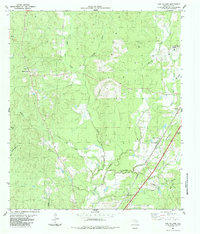
1984 Map of New Willard
USGS Topo · Published 1984About this map
Southern Pacific rail lines and the timber-rich corridors of Polk County define this mid-1970s landscape, as documented by the Texas Department of Water Resources and USGS. The map reveals a network of rural communities including New Willard, Marston, and Leggett, many of which developed around the regional logging and rail infrastructure. Distinctive local landmarks such as Bethel Ch and the Thompson Memorial Ch serve as focal points for these settlements.
Find a feature on this map
28 named features on this map. Tap any name to fly to it.
Don’t see what you’re looking for? This feature index may not catch every label — zoom into the map to look around manually.
Map Details
Editions of this 1984 New Willard Map
This is the sole edition of this map. No revisions or reprints were ever made.
Other maps of this area

1954 · Beaumont
USGS Topo · 1:250,000

1955 · New Willard
USGS Topo · 1:62,500

1957 · Beaumont
USGS Topo · 1:250,000

1958 · Livingston
USGS Topo · 1:62,500

1960 · Blanchard
USGS Topo · 1:24,000

1960 · Colita
USGS Topo · 1:24,000

1961 · Onalaska
USGS Topo · 1:24,000

1984 · Soda
USGS Topo · 1:24,000

1984 · Beaumont
USGS Topo · 1:250,000
1984 · Livingston
USGS Topo · 1:24,000