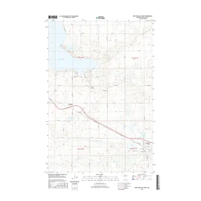
2016 Map of New York Mills West
USGS Topo · Published 2016About this map
Richdale sits at a geographic crossroads in this part of Otter Tail County, where the landscape is defined by the transition from open wetlands to the shores of Big Pine Lake. The settlement patterns here follow the diagonal path of the railway and major thoroughfares like Diamond Rd E, which cut across the traditional township grids of t136n r38w and t135n r37w. This survey is particularly valuable for genealogists, as it documents several burial sites including the Historic Pine Lake Cem, Greenwood Cem, and the Old Greenwood Cem near the western edge of New York Mills. The area's hydrology is complex, with numerous small basins such as Haberman Lake and Nitche Lake feeding into local drainages like Willow Cr and Alvis Cr. This network of water bodies and marshlands shaped the early road placements, seen in the winding routes of Blueberry Rd and Nitche Lake Rd.
Find a feature on this map
56 named features on this map. Tap any name to fly to it.
Don’t see what you’re looking for? This feature index may not catch every label — zoom into the map to look around manually.
Map Details
Editions of this 2016 New York Mills West Map
This is the sole edition of this map. No revisions or reprints were ever made.
Other maps of this area

1912 · Battle Lake
USGS Topo · 1:62,500

1914 · Battle Lake
USGS Topo · 1:62,500

1915 · Perham
USGS Topo · 1:62,500

1953 · Brainerd
USGS Topo · 1:250,000

1957 · Brainerd
USGS Topo · 1:250,000

1958 · Brainerd
USGS Topo · 1:250,000

1965 · Brainerd
USGS Topo · 1:250,000

1969 · New York Mills NW
USGS Topo · 1:24,000

1969 · Heinola
USGS Topo · 1:24,000

1969 · New York Mills West
USGS Topo · 1:24,000
Featured Places
- New York Mills, MN
- Richdale, MN
- Mills Manor Mobile Home Park, New York Mills
- Otter Tail County, MN
- United States