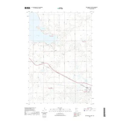
2019 Map of New York Mills West
USGS Topo · Published 2019About this map
New York Mills anchors the southeastern corner of this Otter Tail County landscape, where the grain of the land reflects a dense network of sectional roads and glacial water bodies. The settlement of Richdale sits further northwest along the diagonal path of the railroad and Diamond Rd W, illustrating the classic development pattern of towns following transportation corridors. This area is significant for genealogists, as it preserves the locations of several burial grounds, including Old Greenwood Cem, Greenwood Cem, and the Historic Pine Lake Cem located near the center of the quadrangle. The northern reaches are dominated by significant wetlands and water features such as Big Pine Lake and Nitche Lake, while the southern portion is drained by Willow Cr. The map details a transition from the structured residential blocks in the village to the expansive rural sections that define the region's agricultural character.
Find a feature on this map
38 named features on this map. Tap any name to fly to it.
Don’t see what you’re looking for? This feature index may not catch every label — zoom into the map to look around manually.
Map Details
Editions of this 2019 New York Mills West Map
This is the sole edition of this map. No revisions or reprints were ever made.
Other maps of this area

1912 · Battle Lake
USGS Topo · 1:62,500

1914 · Battle Lake
USGS Topo · 1:62,500

1915 · Perham
USGS Topo · 1:62,500

1953 · Brainerd
USGS Topo · 1:250,000

1957 · Brainerd
USGS Topo · 1:250,000

1958 · Brainerd
USGS Topo · 1:250,000

1965 · Brainerd
USGS Topo · 1:250,000

1969 · New York Mills NW
USGS Topo · 1:24,000

1969 · Heinola
USGS Topo · 1:24,000

1969 · New York Mills West
USGS Topo · 1:24,000
Featured Places
- New York Mills, MN
- Richdale, MN
- Mills Manor Mobile Home Park, New York Mills
- Otter Tail County, MN
- United States