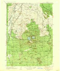
1935 Map of Newberry Crater
USGS Topo · Published 1935About this map
Paulina Lake and East Lake sit deep within the Newberry Crater, forming the centerpiece of a landscape defined by volcanic geology in the 1930s. The region is marked by an extensive collection of cinder cones and lava formations, including Lava Butte, China Hat, and the subterranean Lava River Cave. To the west, the Deschutes River flows past Dillon Falls and Lava Island Falls, providing a corridor for early ranching and settlement.
Find a feature on this map
91 named features on this map. Tap any name to fly to it.
Don’t see what you’re looking for? This feature index may not catch every label — zoom into the map to look around manually.
Map Details
Editions of this 1935 Newberry Crater Map
3 editions found
Other maps of this area

1926 · Bend
USGS Topo · 1:125,000

1929 · Bend
USGS Topo · 1:125,000

1929 · Three Sisters
USGS Topo · 1:125,000

1930 · Maiden Peak
USGS Topo · 1:125,000

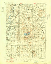
1931 · Newberry Crater
USGS Topo · 1:125,000

1932 · Three Sisters
USGS Topo · 1:125,000

1934 · Maiden Peak
USGS Topo · 1:125,000

1935 · Chemult
USGS Topo · 1:96,000

1935 · Newberry Crater
USGS Topo · 1:125,000

1941 · Chemult
USGS Topo · 1:125,000