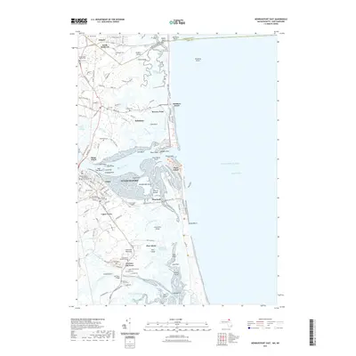
2021 Map of Newburyport East
USGS Topo · Published 2021About this map
Newburyport and its maritime neighbors anchor this coastal survey, where the Merrimack River meets the Atlantic Ocean across the vast Joppa Flats. The map reveals a landscape defined by saltwater marshes and barrier islands, notably the long stretch of Plum Island protected by the Plum Island River. Genealogists will find significant detail in the numerous burial sites, including the First Parish Burying Ground, First Settlers Burying Ground, and several municipal cemeteries like Oak Hill Cem and Wildwood Cem.
Find a feature on this map
127 named features on this map. Tap any name to fly to it.
Don’t see what you’re looking for? This feature index may not catch every label — zoom into the map to look around manually.
Map Details
Editions of this 2021 Newburyport East Map
This is the sole edition of this map. No revisions or reprints were ever made.
Other maps of this area

1886 · Gloucester
USGS Topo · 1:62,500

1888 · Newburyport
USGS Topo · 1:62,500

1888 · Gloucester
USGS Topo · 1:62,500

1888 · Salem
USGS Topo · 1:62,500

1890 · Newburyport
USGS Topo · 1:62,500

1893 · Salem
USGS Topo · 1:62,500

1893 · Gloucester
USGS Topo · 1:62,500

1894 · Newburyport
USGS Topo · 1:62,500

1917 · Salem
USGS Topo · 1:62,500

1918 · Gloucester
USGS Topo · 1:62,500