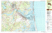
1987 Map of Newburyport
USGS Topo · Published 1987About this map
The Merrimack River dominates this coastal landscape, serving as the central artery for the historic port city of Newburyport and its surrounding communities in the late 1980s. The map illustrates a complex interface of river, marsh, and sea, particularly at the Joppa Flats and the expansive Parker River National Wildlife Refuge on Plum Island. The settlement pattern reflects centuries of history, from the dense grid of the harbor front to the scattered hamlets of Byfield and Newbury Old Town.
Find a feature on this map
87 named features on this map. Tap any name to fly to it.
Don’t see what you’re looking for? This feature index may not catch every label — zoom into the map to look around manually.
Map Details
Editions of this 1987 Newburyport Map
2 editions found
Other maps of this area

1886 · Gloucester
USGS Topo · 1:62,500

1886 · Lawrence
USGS Topo · 1:62,500

1888 · Newburyport
USGS Topo · 1:62,500

1888 · Haverhill
USGS Topo · 1:62,500

1888 · Gloucester
USGS Topo · 1:62,500

1888 · Lawrence
USGS Topo · 1:62,500

1888 · Salem
USGS Topo · 1:62,500

1890 · Haverhill
USGS Topo · 1:62,500

1890 · Newburyport
USGS Topo · 1:62,500

1893 · Salem
USGS Topo · 1:62,500