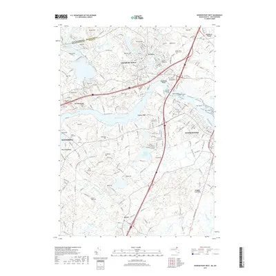
2018 Map of Newburyport West
USGS Topo · Published 2018About this map
The Merrimack River serves as the central artery for this region of the Massachusetts and New Hampshire border, dictating the development of riverside communities like Merrimacport and Salisbury Point. Settlement is densest in Amesbury Town and northern Newburyport, where the Whittier Memorial Bridge connects the banks. The landscape is dotted with family-named elevations such as Whittier Hill, Sawyers Hill, and Archelaus Hill, reflecting generations of land use and local heritage.
Find a feature on this map
73 named features on this map. Tap any name to fly to it.
Don’t see what you’re looking for? This feature index may not catch every label — zoom into the map to look around manually.
Map Details
Editions of this 2018 Newburyport West Map
This is the sole edition of this map. No revisions or reprints were ever made.
Other maps of this area

1886 · Lawrence
USGS Topo · 1:62,500

1888 · Newburyport
USGS Topo · 1:62,500

1888 · Haverhill
USGS Topo · 1:62,500

1888 · Lawrence
USGS Topo · 1:62,500

1888 · Salem
USGS Topo · 1:62,500

1890 · Haverhill
USGS Topo · 1:62,500

1890 · Newburyport
USGS Topo · 1:62,500

1893 · Salem
USGS Topo · 1:62,500

1893 · Lawrence
USGS Topo · 1:62,500

1893 · Haverhill
USGS Topo · 1:62,500