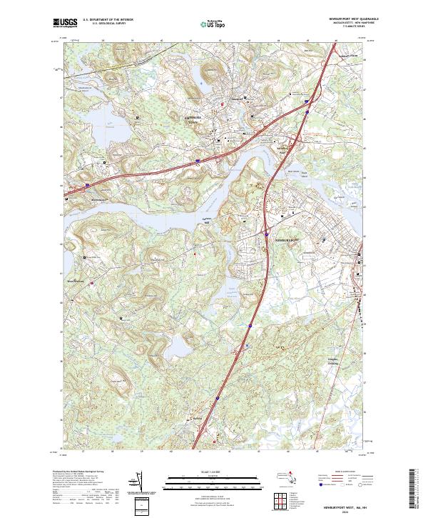
2024 Map of Newburyport West
USGS Topo · Published 2024About this map
The Merrimack River serves as the central artery for this region, separating the industrial and maritime heritage of Newburyport from the northern settlements of Amesbury and Salisbury Point. This contemporary survey highlights a landscape deeply rooted in early Massachusetts history, as evidenced by the dense concentration of historic interments such as the Golgotha Burial Ground and the Old Hill Burial Ground. The interior terrain is defined by numerous glacial drumlins like Powwow Hill and Lone Tree Hill, which overlook complex water systems including the Artichoke Reservoir and Lake Attitash. Local history researchers will find significant landmarks preserved in the modern infrastructure, from the Curzon Mill on the riverbank to the Essex County Newburyport District Courthouse downtown. The map also traces the Border To Boston Trl, showing how former rail corridors have been repurposed for contemporary transit through towns like Byfield.
Find a feature on this map
228 named features on this map. Tap any name to fly to it.
Don’t see what you’re looking for? This feature index may not catch every label — zoom into the map to look around manually.
Map Details
Editions of this 2024 Newburyport West Map
This is the sole edition of this map. No revisions or reprints were ever made.
Other maps of this area

1886 · Lawrence
USGS Topo · 1:62,500

1888 · Newburyport
USGS Topo · 1:62,500

1888 · Haverhill
USGS Topo · 1:62,500

1888 · Lawrence
USGS Topo · 1:62,500

1888 · Salem
USGS Topo · 1:62,500

1890 · Haverhill
USGS Topo · 1:62,500

1890 · Newburyport
USGS Topo · 1:62,500

1893 · Salem
USGS Topo · 1:62,500

1893 · Lawrence
USGS Topo · 1:62,500

1893 · Haverhill
USGS Topo · 1:62,500