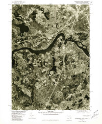
1977 Map of Newburyport West
USGS Topo · Published 1981About this map
The Merrimack River serves as the central artery of this coastal Massachusetts landscape, dividing the industrial and residential centers of Amesbury and Newburyport from the more rural, wooded areas to the south. Produced from 1977 aerial photography, this orthophotoquad provides an unfiltered view of the regional infrastructure during the late seventies, showing the dense network of streets in the town centers contrasted against the winding course of the Powwow River. The photography captures the transition from established mill towns to a post-industrial era, with clear views of the bridges and bypasses that connected these communities.
Find a feature on this map
9 named features on this map. Tap any name to fly to it.
Don’t see what you’re looking for? This feature index may not catch every label — zoom into the map to look around manually.
Map Details
Editions of this 1977 Newburyport West Map
This is the sole edition of this map. No revisions or reprints were ever made.
Other maps of this area

1886 · Lawrence
USGS Topo · 1:62,500

1888 · Newburyport
USGS Topo · 1:62,500

1888 · Haverhill
USGS Topo · 1:62,500

1888 · Lawrence
USGS Topo · 1:62,500

1888 · Salem
USGS Topo · 1:62,500

1890 · Haverhill
USGS Topo · 1:62,500

1890 · Newburyport
USGS Topo · 1:62,500

1893 · Salem
USGS Topo · 1:62,500

1893 · Lawrence
USGS Topo · 1:62,500

1893 · Haverhill
USGS Topo · 1:62,500