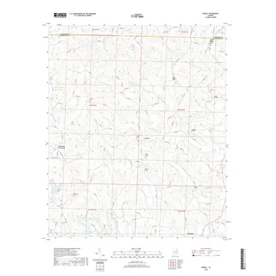
2018 Map of Newell
USGS Topo · Published 2018About this map
Newell and Morrison Crossroads anchor this portion of the northern Alabama hills along the winding path of the Little Tallapoosa River. The landscape is defined by its rural settlement pattern, where small communities like Gold Ridge and Pine Hill are connected by an intricate web of county roads. These routes, such as Co RD 92 and Co RD 51, navigate the ridges and hollows carved by numerous watercourses, including Cohobadiah Cr and Wolf Cr.
Find a feature on this map
114 named features on this map. Tap any name to fly to it.
Don’t see what you’re looking for? This feature index may not catch every label — zoom into the map to look around manually.
Map Details
Editions of this 2018 Newell Map
This is the sole edition of this map. No revisions or reprints were ever made.
Other maps of this area

1889 · Tallapoosa
USGS Topo · 1:125,000

1891 · Ashland
USGS Topo · 1:125,000

1892 · Tallapoosa
USGS Topo · 1:125,000

1897 · Tallapoosa
USGS Topo · 1:125,000

1899 · Wedowee
USGS Topo · 1:125,000

1900 · Anniston
USGS Topo · 1:125,000

1902 · Wedowee
USGS Topo · 1:125,000

1953 · Atlanta
USGS Topo · 1:250,000

1957 · Atlanta
USGS Topo · 1:250,000

1958 · Atlanta
USGS Topo · 1:250,000