
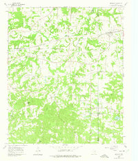
1960 Map of Newsome
USGS Topo · Published 1962About this map
Newsome and the surrounding East Texas countryside were defined by the convergence of rail and resource extraction at the dawn of the 1960s. The Louisiana & Arkansas (KCS) line cuts through the northern landscape, serving the Newsome Oil Field and the rural communities of Clearwater and Scroggins. This survey captures a densely settled agricultural and industrial network where family-named landmarks like Stivers Hill stand near clusters of community life, including the Hepsibah Baptist Ch and Maple Springs Ch.
Find a feature on this map
46 named features on this map. Tap any name to fly to it.
Don’t see what you’re looking for? This feature index may not catch every label — zoom into the map to look around manually.
Map Details
Editions of this 1960 Newsome Map
3 editions found
Other maps of this area

1953 · Texarkana
USGS Topo · 1:250,000

1956 · Texarkana
USGS Topo · 1:250,000

1956 · Tyler
USGS Topo · 1:250,000

1960 · Winnsboro
USGS Topo · 1:24,000

1960 · Cartwright
USGS Topo · 1:24,000

1960 · Thomas
USGS Topo · 1:24,000

1960 · Leesburg
USGS Topo · 1:24,000

1960 · Rhonesboro
USGS Topo · 1:24,000

1964 · Purley
USGS Topo · 1:24,000

1965 · Monticello
USGS Topo · 1:24,000