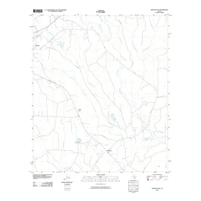
2010 Map of Newton East
USGS Topo · Published 2010About this map
Newton sits at the western edge of this East Texas landscape, where the town's grid meets a dense network of forest roads and creek drainage systems. The area is defined by the convergence of numerous waterways, including Quicksand Creek, Threemile Branch, and Caney Creek, which eventually feed into the Temple Eastex Lake created by the Temple Eastex Dam. This 2010 survey highlights the rural infrastructure of Newton County, where named routes like Klines Ferry Rd and Lee's Mill Rd hint at the historical river-crossings and timber-processing sites that shaped the local economy.
Find a feature on this map
29 named features on this map. Tap any name to fly to it.
Don’t see what you’re looking for? This feature index may not catch every label — zoom into the map to look around manually.
Map Details
Editions of this 2010 Newton East Map
This is the sole edition of this map. No revisions or reprints were ever made.
Other maps of this area

1935 · Wilson Lake
USGS Topo · 1:31,680

1946 · Merryville
USGS Topo · 1:31,680

1947 · Wilson Lake
USGS Topo · 1:31,680

1947 · Bivens
USGS Topo · 1:31,680

1949 · Evans
USGS Topo · 1:31,680

1952 · Lake Charles
USGS Topo · 1:250,000
1954 · Merryville
USGS Topo · 1:31,680
1954 · Bivens
USGS Topo · 1:31,680

1954 · Lake Charles
USGS Topo · 1:250,000

1955 · Roganville
USGS Topo · 1:62,500