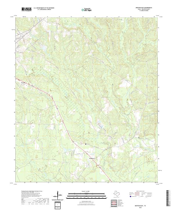
2022 Map of Newton East
USGS Topo · Published 2022About this map
Newton sits at the western edge of this East Texas landscape, where the town street grid transitions into a complex network of creeks and timbered drainage basins. The area is defined by the southeastern flow of Quicksand Cr and its many tributaries, including Little Quicksand Cr and Moore Br. The settlement of Buckhorn anchors the southern portion of the sheet near Temple Eastex Lake, illustrating the rural development patterns of Newton County. Local history is preserved in the placement of the Ford Cem and Quicksand Cem, while names like Klines Ferry Rd and Old Willis Rd hint at earlier transportation corridors that once connected these isolated communities through the dense piney woods terrain.
Find a feature on this map
63 named features on this map. Tap any name to fly to it.
Don’t see what you’re looking for? This feature index may not catch every label — zoom into the map to look around manually.
Map Details
Editions of this 2022 Newton East Map
This is the sole edition of this map. No revisions or reprints were ever made.
Other maps of this area

1935 · Wilson Lake
USGS Topo · 1:31,680

1946 · Merryville
USGS Topo · 1:31,680

1947 · Wilson Lake
USGS Topo · 1:31,680

1947 · Bivens
USGS Topo · 1:31,680

1949 · Evans
USGS Topo · 1:31,680

1952 · Lake Charles
USGS Topo · 1:250,000
1954 · Merryville
USGS Topo · 1:31,680
1954 · Bivens
USGS Topo · 1:31,680

1954 · Lake Charles
USGS Topo · 1:250,000

1955 · Roganville
USGS Topo · 1:62,500