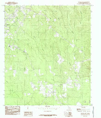
1984 Map of Newton East
USGS Topo · Published 1985About this map
The eastern edge of Newton and its surrounding timberlands are documented in this mid-1980s provisional study, showing a landscape defined by a dense network of creek drainages. Major waterways such as Quicksand Creek and Little Quicksand Creek carve through the terrain, joined by numerous tributaries including Threemile Creek and Caney Creek. The settlement pattern is sparse beyond the primary township, with the small community of Buckhorn located to the south.
Find a feature on this map
14 named features on this map. Tap any name to fly to it.
Don’t see what you’re looking for? This feature index may not catch every label — zoom into the map to look around manually.
Map Details
Editions of this 1984 Newton East Map
This is the sole edition of this map. No revisions or reprints were ever made.
Other maps of this area

1935 · Wilson Lake
USGS Topo · 1:31,680

1946 · Merryville
USGS Topo · 1:31,680

1947 · Wilson Lake
USGS Topo · 1:31,680

1947 · Bivens
USGS Topo · 1:31,680

1949 · Evans
USGS Topo · 1:31,680

1952 · Lake Charles
USGS Topo · 1:250,000
1954 · Merryville
USGS Topo · 1:31,680
1954 · Bivens
USGS Topo · 1:31,680

1954 · Lake Charles
USGS Topo · 1:250,000

1955 · Roganville
USGS Topo · 1:62,500