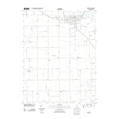
2012 Map of Newton
USGS Topo · Published 2012About this map
The Embarras River winds through the northern landscape of this Jasper County region, anchoring the city of Newton. This area reflects a deeply established rural cemetery network, including Riverside Cem and West Lawn Cem near the town center, and smaller family or community burial grounds like Vanderhoof Cem and Honey Cem scattered across the township. The landscape is defined by a dense grid of county roads and numerous watercourses such as Hurricane Cr and the W Fork Wetweather Cr, which drain the agricultural land between smaller settlements like Bogota and Shamrock. In the east, the Jasper County Flying Club Airport stands near the intersection of several local routes, while the western edge is marked by the shoreline of Newton Lake. This survey captures the transition of a traditional Illinois farming community into the modern era.
Find a feature on this map
82 named features on this map. Tap any name to fly to it.
Don’t see what you’re looking for? This feature index may not catch every label — zoom into the map to look around manually.
Map Details
Editions of this 2012 Newton Map
This is the sole edition of this map. No revisions or reprints were ever made.
Other maps of this area

1940 · Greenup
USGS Topo · 1:62,500

1941 · Newton
USGS Topo · 1:62,500

1943 · Greenup
USGS Topo · 1:62,500

1943 · Newton
USGS Topo · 1:62,500

1953 · Teutopolis
USGS Topo · 1:62,500

1953 · Sailor Springs
USGS Topo · 1:62,500

1958 · Decatur
USGS Topo · 1:250,000

1958 · Belleville
USGS Topo · 1:250,000

1961 · Decatur
USGS Topo · 1:250,000

1962 · Belleville
USGS Topo · 1:250,000